Saturday, 18 April 2015 00:00
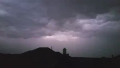
Severe storm approaching southern Denton County as viewed from Lantana.
Severe storm approaching southern Denton County as viewed from Lantana.
A fast moving thunderstorm hit southern Denton County around 8 p.m. Saturday, bringing high wind, hail, power flashes and a torrential downpour.
The Town of Flower Mound activated its sirens around 8 p.m. to warn residents of the potential for damaging straight-line winds, projected at 60-70 mph. At DFW Airport, winds were clocked at around 55 mph.
Pea-sized hail was reported in parts of Flower Mound, Lewisville and Lake Dallas. The storm dropped an additional .86″ of rain one day after storms dumped just more than an inch. The total rainfall so far this year is near 13 inches.
Power outages around the DFW Metroplex were reported, at one point with an estimated 58,000 without power.
The quick-moving line has already spawned several funnel clouds, hail in Decatur and high winds causing roof damage near Granbury and downing trees and flooding across the southwestern counties in its path.
At 7:45 p.m., the National Weather Service in Fort Worth issued a Severe Thunderstorm Warning for Denton County until 8:45 p.m. with a Flash Flood Warning until 11 p.m. A thunderstorm watch continued until 1 a.m.
Rain began falling around 6 p.m. as some early showers spread over southern Denton County though a line of heavier showers was quickly moving in from the west.
The Flower Mound Fire Department released this statement on Monday:
Many of you may have heard Flower Mound’s Outdoor Warning Siren System activate on Saturday, April 18. This system consists of 14 sirens (5 more will be added in the coming weeks) located throughout the Town that are designed to inform residents who are outside during a possible emergency. These sirens are activated when one or more of the following criteria is met:
– Reported hail of 1.25” in diameter or greater
– Rotation in a dangerous cloud or a tornado
– Straight-line winds over 70 mph
It’s important to remember, these are NOT tornado sirens, they alert residents to all kinds of weather-related emergencies. Also, if you were at home and did not hear the sirens, that is because the system is not designed to alert those who are within a home or other structure. The warning sirens are meant to get the attention of those outside, most at risk of dangerous weather moving into the area.
To see where the Outdoor Warning Sirens are located in Town, or for more information on their activation, please visit:http://www.flower-mound.com/sirens.


